Our Ecological Services:
Technical Services (Mapping)
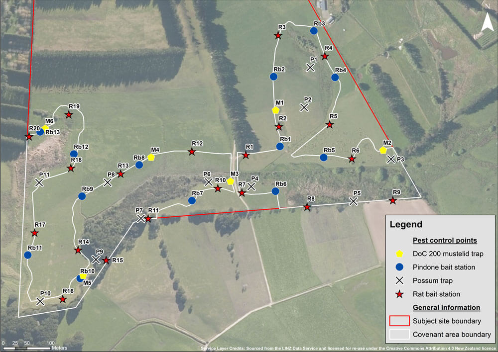
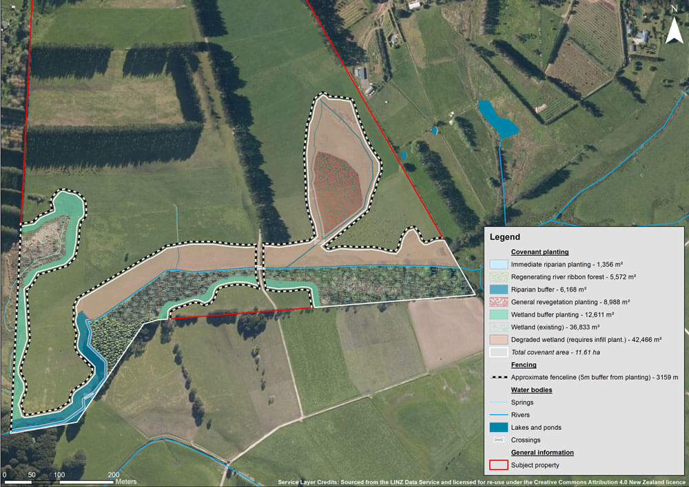
Long gone are the days of pencil-drawn maps to guide us! Professional spatial mapping is essential. We offer a range of services in relation to spatial surveys and analysis, from simple habitat delineation mapping projects, to complex environmental modelling.
Daily, we use GIS software to improve the accuracy, reliability and usability of the findings of our ecological surveys. To inform planning applications; GIS means we can present results and recommendations in ‘real world’ environment, illustrated on specialised maps and in various data formats for seamless inclusion within any project.
Complex patterns and relationships can be analysed and visualised in the context of real landscape spaces, and over time. GIS technology is vital in all of our projects and often involves detailed habitat mapping, analysis of vegetation patterns and habitats over time, as well as mapping of pest plants and animals.
GIS allows us to spatially analyse large sites very quickly and with precision, which helps budget considerations for our clients. It is an integral tool in our work and is used from the planning stages of a project all the way through to the physical works, through to follow-up control and monitoring, reporting and mapping.
We use GPS units in our work, which tie into our in-house GIS system. Using a GPS helps with follow-up control in maintenance and for thorough reporting and analysis. This gives clients confidence that no areas are missed or covered twice, and sites that are isolated are recorded (with the information made available for follow-up control next season). All data is then used for the production of annual monitoring and compliance reports.
 |
 |